Teleport your device anywhere instantly with one click.


 100% Security Verified | No Subscription Required | No Malware

 :

 ChatGPT
 Perplexity
 Gemini
 Claude
 Grok
A Pokémon GO radar can help you choose where to explore, but a marker is not a guarantee that a Pokémon is still there. Check the report's time, the area covered, and whether the service shows wild sightings, permanent points of interest, or raids. Those are different kinds of information, and each becomes outdated at a different rate.
For raid coordination, Campfire offers an official companion workflow. Community maps can add useful local context, while less verifiable services require caution. The comparison below keeps all five original entries for 2026 without treating an accessible website, an old screenshot, or a marketing claim as proof of accurate live coverage.
Use reported coordinates to plan lawful, safe real-world exploration. Changing the location reported to Pokémon GO is prohibited by the game's rules, whether a tool works technically or not. The later device-coordinate sections therefore explain compatibility and general testing separately from legitimate gameplay.

In this article
Part 1: What a Pokémon GO Radar Actually Shows
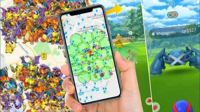
A Pokémon GO radar is a map or report interface that presents location-related information outside the ordinary in-game Nearby view. Depending on the service, markers may represent a community sighting, a Gym, a PokéStop, a reported nest, or a scheduled raid. A map that is good at permanent landmarks is not necessarily a live Pokémon scanner.
How Reports Become Map Markers
Some services rely on players submitting discoveries; others advertise scanning or a mixture of data sources. Before trusting a marker, find out what the source actually is. A submission timestamp tells you when someone reported something, not how long a spawn will remain or whether every player will encounter the same thing.
Common functions are useful only when the underlying information supports them:
- Species filtering: hides irrelevant reports, but cannot create missing observations.
- Timing information: may help assess urgency if its meaning and source are clear.
- Gym and raid layers: can support route planning and group coordination without implying wild-spawn coverage.
- Alerts: notify you about matching reports where the app and region provide them; delivery does not certify the report.
When a Radar Helps and When Nearby Is Better
A current local map can reduce aimless searching by highlighting places worth investigating. It is most useful when you can identify an accessible public location and confirm relevant activity in Pokémon GO. For a nearby encounter, the game's own view and an actual visit remain more meaningful than an unverified marker on a distant map.
Do not equate frequent page refreshes with fresh observations. A service can reload continuously while displaying an old submission. Before setting out, check the last report, the distance and safe route, opening hours if relevant, and whether the information has local corroboration. Never trespass, drive while playing, or chase a countdown into an unsafe area.
Part 2: Five Radar and Map Options to Assess in 2026
The original directory's 'best' label is retained in its navigation, but these services do not share one verified feature set or coverage area. Choose according to the task: sightings, points of interest, or raid coordination. No universal live-data ranking or nationwide reliability claim is established here.
1. PokéMap: Community Sightings and Submitted Landmarks
PokéMap's readable website describes a collaborative map where visitors can add discovered Pokémon and search for a species. It also exposes options for showing and adding Gyms or PokéStops and links to a Pokédex. Those functions make it relevant when you want an overview of community-reported activity in an area.
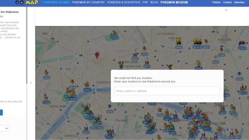
To evaluate it, search your intended location, select the species or map layer, and inspect what the markers actually report. Compare their timing and position with what you can verify locally. Although the site uses real-time language, that wording is not an independent guarantee that a specific report remains valid when you arrive. Contribute only accurate discoveries and avoid submitting private information about other players.
2. PogoMap: Crowdsourced Points of Interest
PogoMap's own FAQ says its data is crowdsourced from registered members and that it does not use third-party APIs. It describes adding locations, voting on existing entries, and viewing or reporting raid and task information. That makes it useful for exploring reported Gyms and PokéStops rather than assuming it automatically scans all wild spawns.
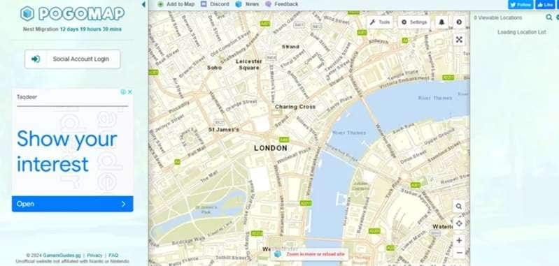
Search an area, inspect the available layers, and open a marker to review its details. Distinguish a relatively stable landmark from a temporary raid or nest report. The page also labels a world-sightings feature as coming soon, so do not promote that label as an already operating comprehensive radar. Check the game before relying on a community location that may have changed.
3. Niantic Campfire: Raid Planning and Team Up
Campfire is the official companion option in this comparison. Its current support documentation describes Team Up as a way for Pokémon GO Trainers to host and join nearby raid groups. It is a coordination tool, not a promise to show every wild Pokémon or every rare spawn around the world.
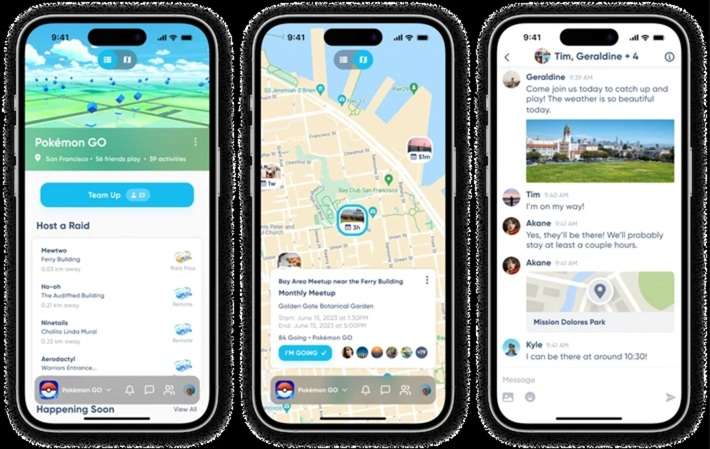
Open the Campfire map from Pokémon GO or the Campfire app, then choose Team Up if available. Select the option to host or join a raid and follow the group prompts. The official workflow includes accepting the host's friend request to receive an invitation and returning to Pokémon GO for the raid. Availability and in-game participation requirements still apply; a map listing is not itself a raid entry.
For real-world meetups, choose public, appropriate places and protect your personal information. A companion app helps coordinate people; it does not remove the need for normal safety judgment or the game's current rules.
4. WeCatch: Filtered Reports and Notifications
The current Apple listing for WeCatch - Radar & Map by CD Studio describes map filters, Pokémon and raid information, and notification features. It identifies the app as fan-built and not affiliated with the game brands. Its current description also says that no account is needed and that notification filters should be set first, correcting the source article's login requirement.
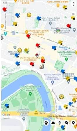
Inspect the current store listing on your device, open the relevant map area, and set filters before enabling notifications. Check whether your area actually has fresh reports before relying on alerts. The presence of an app-store page does not certify worldwide coverage, developer data accuracy, or endorsement by the game operator. Review the app's privacy disclosures and permissions as well as its feature list.
5. GymHuntr: Do Not Assume the Original Service Is Operating
The source describes GymHuntr as a Gym-focused radar with team-control, defender, and raid details. However, the supplied service name could not be verified as an accessible operating map at its commonly associated website during this review. An old interface image is not evidence that these functions remain available in 2026.
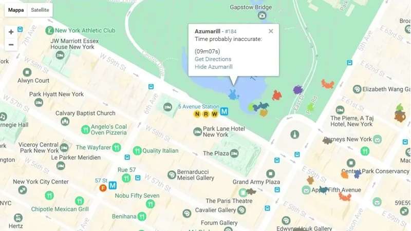
If you encounter a similarly named service, confirm its publisher and current status before using it. Do not provide game credentials or install a download merely because it promises to revive the old map. For today's raid-planning task, inspect Pokémon GO and Campfire first; do not make a journey based solely on an unverified GymHuntr screenshot or an old ownership report.
Part 3: Understand iPhone Coordinates and Dr.Fone's Separate Role
A coordinate is a geographic reference, not permission to teleport an account in Pokémon GO. Read a map report as a destination for planning a real visit. The game's current player guidelines explicitly prohibit tools or techniques that falsify location and describe possible account penalties. Technical support for an iPhone does not override those rules.
 Set your map route to simulate GPS movement.
- Set your wanted movement speed.
- HD and large map view to check location.
- Fake GPS location to anywhere.
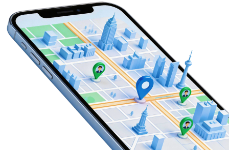
Dr.Fone - Virtual Location offers device-coordinate simulation, route modes, and joystick-style movement controls on supported configurations. These are general GPS functions; the tool is not a radar, does not verify a reported Pokémon, and cannot guarantee that a game will accept the resulting position.
For an authorized test on your own supported iPhone, keep Pokémon GO closed and use a non-game map or an app you control. Check current device and system requirements before starting. The official product page's general iOS discussion must not be interpreted as a promise of undetectable gameplay or account safety.
- Teleport: select a test coordinate and inspect the resulting device position.
- Route simulation: model movement between map points with supported speed and repetition controls.
- Manual direction controls: inspect simulated movement where the current software offers a joystick.
- Supported-device setup: follow the current connection instructions rather than assuming every iPhone or system version is compatible.
Four Steps for a Non-Game iPhone Coordinate Test
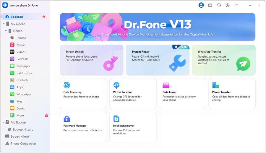
Step 1 Connect the supported iPhone
Launch the desktop software on Windows or Mac, open Virtual Location, and connect your own device. Complete the required trust and connection prompts. If recognition fails, stop and resolve the documented setup issue first.
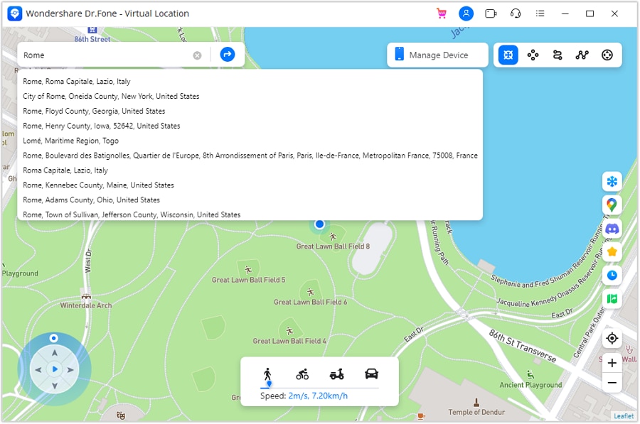
Step 2 Enter a coordinate for the test
Choose the teleport function and enter the intended coordinate or address. Check the result carefully, including latitude and longitude order. Coordinates copied from a report may identify an approximate location rather than a precise accessible entrance.
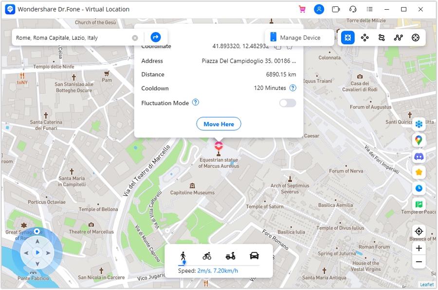
Step 3 Confirm and inspect the position
Review the point on the desktop map, use the move control, and inspect a non-game map on the phone. This confirms only the observable behavior of that device and app; it says nothing about whether a Pokémon report is current.
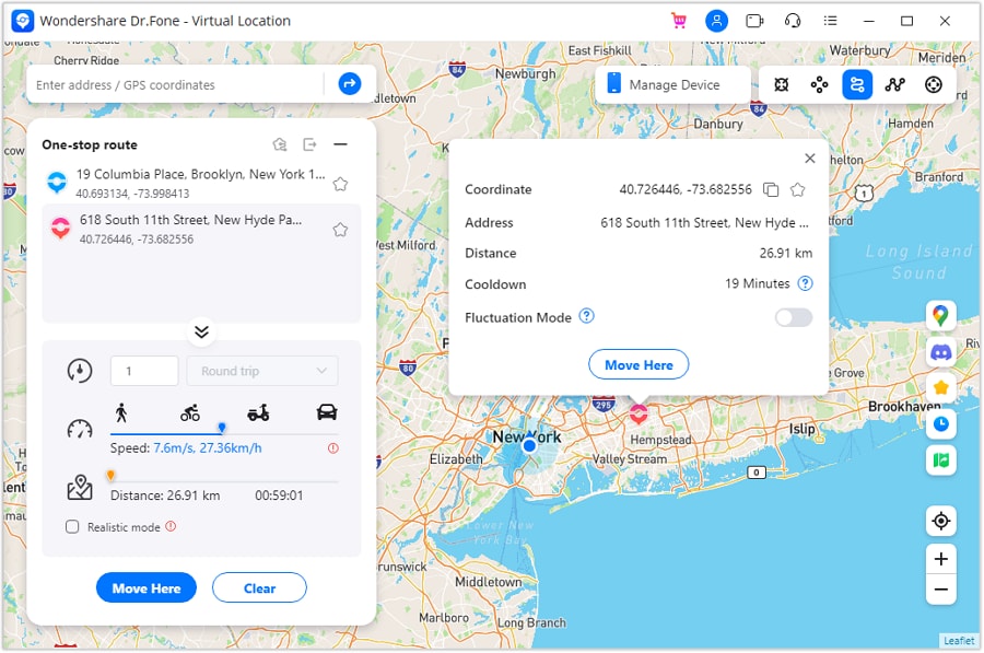
Step 4 Test routes if needed, then restore location
For a legitimate route simulation, inspect One-Stop or Multi-Stop mode, choose test points, and use only the controls needed for that test. When finished, stop the simulation and confirm the phone reports its real location. Do not use the test to play Pokémon GO from a false position.
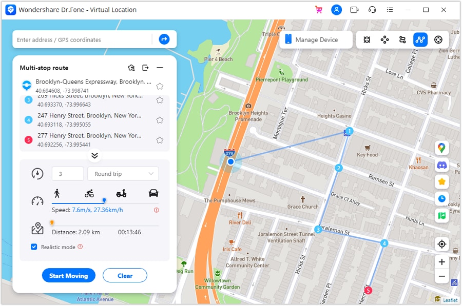
The complete workflow ends after the final route illustration and restoration check. No movement speed, cooldown, or joystick setting creates an exemption from Pokémon GO's anti-spoofing rules.




Part 4: Android Coordinates Are Not Pokémon GO Compatibility
On Android, mock location is a development and testing function. A phone may support that function while Pokémon GO rejects the resulting location. The current Dr.Fone product page explicitly states that its Android support does not support Pokémon GO. A generic Android location-changing claim must not be used to recommend it for this game.
The four-stage setup below preserves the source's Android workflow only for a test app or other authorized non-game use. For normal Pokémon GO play, turn off mock-location use and rely on your real position, the in-game map, and legitimate raid tools.
Step 1 Expose development controls for a genuine test
On your own Android device, locate Build number in the appropriate About phone or software-information screen. Android's documentation describes tapping it seven times to expose Developer options. Manufacturer menu paths vary, and this is not a game-compatibility step.
Step 2 Choose a testing tool deliberately
Use a legitimate location-test application whose publisher and permissions you can evaluate. Do not install modified game clients, provide Pokémon GO credentials, or assume store distribution establishes permission for game spoofing.
Step 3 Associate the test provider
Where your device offers Select mock location app under Developer options, select the intended testing provider. Keep unrelated debugging settings unchanged. The availability of that menu does not establish that every app accepts mock data.
Step 4 Inspect a test coordinate and clean up
Enter a coordinate in the testing tool and inspect it only in the non-game app you are authorized to test. End the test, remove the mock provider or turn it off, and verify real positioning before returning to navigation or ordinary gameplay.
Conclusion
For a useful Pokémon GO map, prioritize recent local information over impressive feature claims. PokéMap and PogoMap describe community contributions; Campfire supplies an official raid-group workflow; WeCatch advertises filtered reports and alerts; GymHuntr's present operation was not verified. These differences matter more than calling every option a live radar.
Dr.Fone - Virtual Location belongs in a separate discussion of supported GPS tests, not as evidence that a Pokémon will appear or that spoofing is permitted. Android Pokémon GO support is explicitly excluded, and iPhone location simulation does not remove account-rule risks. Plan safe real-world exploration and confirm information in the game.
FAQ
1. Does a radar marker guarantee a live Pokémon spawn?
No. A marker can represent a community report that is stale, incomplete, or approximate. Check its time and data source and confirm in Pokémon GO when you reach a safe, accessible location.2. Is Campfire a complete wild-Pokémon radar?
No. The official Team Up workflow focuses on hosting or joining raid groups. It should not be described as a complete map of every wild spawn.3. Must I log in to the current WeCatch app for alerts?
The Apple listing read for this review states that no account is needed and that notification filters should be configured first. Check the exact current version and permissions on your device rather than following an older login instruction.4. Can I safely use radar coordinates to spoof Pokémon GO?
No safe or permitted guarantee is available. The game's player guidelines prohibit falsifying location. Dr.Fone's Android page explicitly excludes Pokémon GO, and general iPhone GPS functions do not override the game's rules.
 Add Wondershare Dr.Fone as a preferred source on Google